Rains expected this Wednesday due to the arrival of a tropical wave in Yucatan.
MÉRIDA, Yucatán, (August 11, 2021).- This Wednesday, August 11th, a tropical wave will arrive in Yucatan that will affect the region until next Friday, which will cause rains throughout the State including the Yucatan coast.
Starting this Wednesday, tropical wave number 23 will move over the Yucatan Peninsula and will interact with the vortex at higher levels.
This will generate accumulated heavy rains, with abundant electrical activity and strong gusts of wind in the central, eastern, and northwestern areas of Yucatan.
Temperatures will stay in the hot to very hot ranges during the day and warm at night.
On Saturday, the potential for rain will decrease, however on Sunday another tropical wave will arrive that will most likely bring bad weather to the region. Mathematical models indicate that it has a tendency to become a depression or a tropical storm.
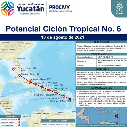
Potential cyclone 6 still far from the Peninsula
The potential tropical cyclone 6 is located this Tuesday over southern Puerto Rico, located 40 miles from Ponce, with winds that have increased to 40 miles per hour (mph), reported the National Hurricane Center (NHC) in their August, 10th, 8:00 pm newsletter.
At the moment its trajectory does not represent a danger for the Peninsula.

Source: Sipse
TYT Newsroom


