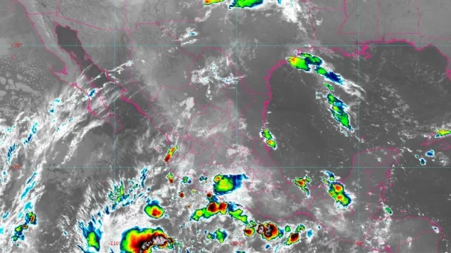
Tropical Storm Lidia strengthened on Wednesday in the Mexican Pacific, where it could cause “very heavy” rains in the western states of the country, warned the National Meteorological Service (SMN).
Lidia was located 700 kilometers southwest of the port of Manzanillo, in the state of Colima, and 765 kilometers south-southwest of Cabo Corrientes, Jalisco.
The phenomenon presents maximum sustained winds of 75 kilometers per hour, gusts of 95 kilometers per hour and a displacement towards the north-northwest at 13 kilometers per hour, according to the report of the agency of the National Water Commission (CONAGUA).
The new forecast estimates that Lidia will remain as a tropical storm until Monday, although its predicted path is moving away from Mexican territory.
Even so, “the cloud detachments reinforce the probability of heavy to punctual very heavy rains in the west of the country”, warned the SMN.
The forecast rainfall, the warning indicated, would be accompanied by electrical discharges and conditions for hail, and could increase the levels of rivers and streams, overflows, landslides and floods.
For this reason, the agency requested “extreme precautions to the population in general in the areas of the mentioned states due to rains, wind and waves, including maritime navigation, and to attend the recommendations issued by the authorities of the National Civil Protection System”.
Lidia is the twelfth named cyclone of this season in the Pacific, where Adrian, Beatriz, Calvin, Dora, Eugene, Fernanda, Greg, Hilary, Irwin, Jova and Kenneth have also formed.
Of these, the most damaging has been Hilary, which in August left four dead in the states of Baja California, Baja California Sur and Sinaloa.
The Mexican government predicted in May the formation of up to 38 named cyclones in the 2023 season, of which five would hit the country.
Of that number, between 16 and 22 systems could occur in the Pacific Ocean, and between 10 and 16 in the Atlantic Ocean.
TYT Newsroom


