
Tropical Storm Gordon, the seventh named storm of what’s predicted to be an extremely active 2024 Atlantic hurricane season, was on the move far out over open waters Saturday, where it’s expected to continue for a few days without posing a threat to land.
As of Saturday morning, the storm was about 2,300 miles from the U.S. East Coast and is moving to the west-northwest at 9 mph.
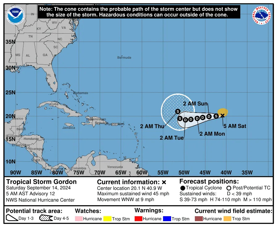
The official forecast track from the National Hurricane Center shows Gordon slowly meandering west across the open Atlantic for the next few days, potentially even weakening to a tropical depression.
Beyond that, most computer models show the system curving out to sea away from North America.
Meanwhile, Francine, which made landfall Wednesday along the Louisiana coast as a Category 2 hurricane, weakened to a post-tropical cyclone.
“The risk of flash and urban flooding will continue across portions of the Tennessee Valley and Southeast through Saturday,” the NHC said in a Friday night advisory.
Where is Tropical Storm Gordon?
At 5 a.m. EDT Saturday, the center of Tropical Storm Gordon was located about 1,145 miles west-northwest of the Cabo Verde Islands. Maximum sustained winds were about 45 mph.
The storm is moving toward the west-northwest at 9 mph. A slow turn toward the west, or southwest is forecast over the next couple of days, with the system slowing down through the weekend.
The Hurricane Center said it could downgrade to a depression over the next day.
Gordon is the seventh named storm of the season
Gordon is the seventh named storm of the season. If it becomes a hurricane, which is not predicted, it would be the fifth hurricane of the season, joining Beryl, Debby, Ernesto, and Francine.
It’s also only the second named storm to form since Aug. 12. The last time that the Atlantic had only one named storm formation between Aug. 13 and Sept. 12 was 1997, according to Colorado State University hurricane researcher Phil Klotzbach.
A typical year sees 14 named storms, of which 7 spin into hurricanes; some predictions for this year were calling for as many as 33 named storms.
With information from AccuWeather
TYT Newsroom
