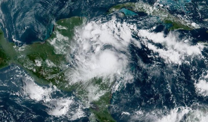
Nana’s circulation will drive tropical maritime air towards the Peninsula, so moderate to heavy rains are forecast, accompanied by electrical activity and with gusts of more than 60 kilometers per hour, on Friday, Sep. 4, in the east and south of Yucatán.
The National Hurricane Center is no longer tracking the short life of Hurricane Nana, as the system degenerated into a tropical storm and then a remnant low Thursday. Tropical Depression Omar is expected to start fizzling out as well. But the tropics remain a busy place as the NHC tracks four systems with odds of development in the Atlantic.
Tropical Depression Omar was located about 415 miles east-northeast of Bermuda with maximum sustained winds of 30 mph moving east near 7 mph, and likely to become a remnant low Friday, the NHC said in its 5 a.m. Friday advisory. The storm is not believed to make any threat of landfall.
Meanwhile, multiple systems are popping up on the NHC’s radar, as of the 8 a.m. update.
First, the NHC is eyeing a tropical wave with a vast area of disorganized thunderstorms and has a high chance of development near the Cabo Verde Islands. The system is moving west-northwest at 15 mph. Slow development is expected as the system could become a tropical depression or tropical storm sometime next week. The NHC gives it a 20% chance to form in the next two days and 70% chance in the next five days.
Second, an area of low pressure closer to the Caribbean is seeing gradual development. The low is several hundred miles west-southwest of the Cabo Verde Islands. The NHC gives it a 20% chance to form in the next two days and 40% chance in the next five days.
Next, the NHC is monitoring another tropical wave hanging over Africa, which should push out over sea sometime over the weekend. The system has a 50% chance of formation in the next five days.
Finally, in the north-central Atlantic, the NHC is observing a non-tropical area of low pressure about 600 miles south of Cape Race Newfoundland expected to move north-northeastward at 15 mph. Forecasters said some slight subtropical or tropical development could occur before it reaches cooler waters Friday night. The NHC gives it a 20% chance of formation in the next two days.
The remaining names for the 2020 season are Paulette, Rene, Sally, Teddy, Vicky and Wilfred.
If the total amount of 2020 storms exceeds the designated name list; which it is expected to, hurricane specialists will begin using letters from the Greek alphabet to name storm; a tactic meteorologists have only had to use once before in 2005, which had a total of 28 named storms.
Source: Accuweather


